Understanding Peru’s Geography
Peru geography
A Complete Guide to Peru's Diverse Landscapes
Exploring the Geography of Peru: Three Distinct Worlds
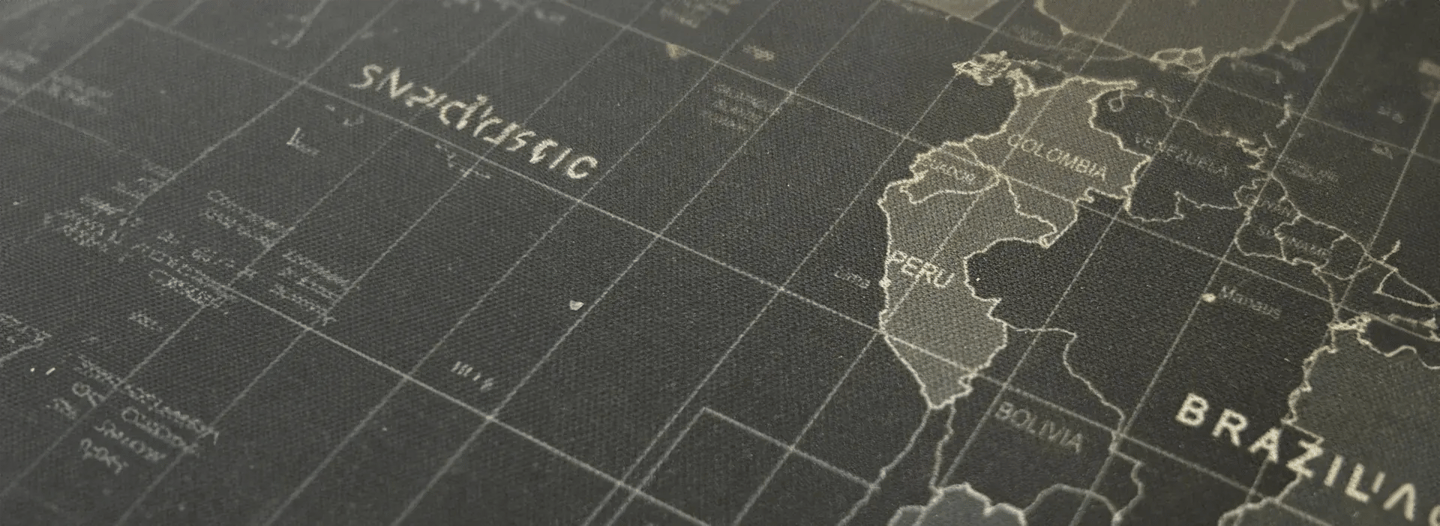
The geography of Peru presents one of the most dramatic and diverse landscapes on Earth, where three distinct regions run parallel from north to south, creating a vertical tapestry of ecosystems unmatched anywhere in the world. Peru is traditionally described in terms of three broad longitudinal regions: the arid Costa on the west; the rugged Sierra, or Andes, system in the centre; and the wet and forested Amazonia—the tropical Amazon Basin—on the east. This extraordinary geographical diversity shapes everything from climate patterns to cultural traditions, making Peru a land of remarkable contrasts where coastal deserts, snow-capped peaks, and tropical rainforests coexist within a single nation.

Explore Vacation Options
Peru Regions
Peru’s Diverse Landscapes
Understanding Peru geographic regions is essential for visitors planning their journey through this South American treasure. Each region offers unique experiences, from exploring ancient coastal civilizations to trekking mountain passes and discovering wildlife in pristine rainforest. The country’s varied terrain creates distinct microclimates and ecosystems, supporting incredible biodiversity while providing the backdrop for Peru’s rich cultural heritage and world-famous archaeological sites.

The Coastal Region
Desert Plains Along the Pacific
The coastal region of Peru stretches approximately 2,414 kilometres along the Pacific Ocean, forming a narrow desert plain that accounts for roughly 12% of the country’s total area. Despite being the coastal region of Peru, much of the terrain here is primarily desert, making it one of the driest coastal regions in the world. This seemingly inhospitable landscape contains Peru’s capital, Lima, and supports over half the nation’s population through fertile river valleys that cut through the arid terrain.
Coastal Characteristics:
- Width ranges from 20-30 kilometres in the north to narrower strips in the south.
- Contains major deserts including Sechura and Nazca.
- River valleys create agricultural oases flowing from the Andes.
- Home to ancient civilizations like the Nazca and Chimú.
- Mild temperatures year-round influenced by the Humboldt Current.

Key Coastal Cities and Attractions

Lima
Capital and primary international gateway
Trujillo
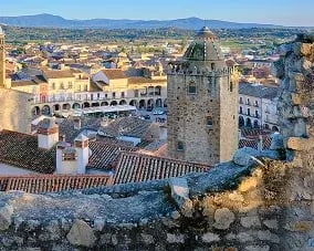
Colonial architecture and Chan Chan ruins
Nazca
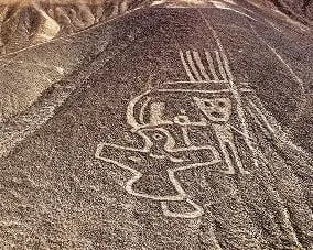
Mysterious geoglyphs visible from the air
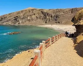
Paracas
Marine wildlife and coastal reserves
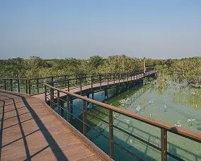
Tumbes
Mangrove forests and northern beaches
The unique climate of the coastal region results from the cold Humboldt Current meeting warm equatorial waters, creating minimal rainfall and persistent fog known as “garúa” during winter months.
The Andes Mountain
Peru's Mountainous Backbone
Peru’s terrain reaches its most dramatic heights in the Sierra region, where the Peruvian Andes are typical of mountain regions of the Pacific Rim: they are young in geologic terms, and their continuing uplift is manifested by frequent earthquakes and much instability. The Andes in Peru form the longest continental mountain range in the world, extending 7,000 kilometres through seven South American countries and representing approximately 30% of Peru’s territory.
Peru Altitudinal Zones and Mountain Ranges
The Andean region features distinct altitude zones creating diverse ecosystems
- Yunga : (500-2,300m): Warm intermountain valleys.
- Quechua : (2,300-3,500m): Temperate agricultural zones.
- Suni : (3,500-4,000m): High-altitude potato cultivation.
- Puna :(4,000-4,800m): Cold grasslands with camelids
- Janca : (above 4,800m): Snow-covered peaks and glaciers.

Geographic Comparison of Andean Peaks
Mountain
Elevation
Region
Significance
Huascarán
6,768m (22,205 ft)
Ancash
Peru's highest peak
Yerupajá
6,634m (21,765 ft)
Huánuco/Lima
Second highest
Coropuna
6,425m (21,079 ft)
Arequipa
Southern volcanic peak
Ampato
6,288m (20,630 ft)
Arequipa
Archaeological significance
Coropuna
6,425m (21,079 ft)
Cusco
Sacred Inca mountain
Every Trip With Us Creates A Positive Impact
Join us on a journey where every trip you take contributes to a positive change, supporting communities and preserving Peru’s wonders.
Cordillera Blanca Peru
The World's Highest Tropical Range
The Cordillera Blanca Peru represents the crown jewel of the Peruvian Andes. It is the most extensive tropical ice-covered mountain range in the world and has the largest concentration of ice in Peru. This spectacular range stretches 200 kilometres through northern Peru, featuring 27 peaks above 6,000 meters and serving as a continental divide between Pacific and Atlantic watersheds.
Cordillera Blanca Features:
- Location : Ancash Region, northern Peru.
- Huascarán, the highest peak, rises to an elevation of 6,768 m above sea level
- Protected by Huascarán National Park (UNESCO World Heritage Site)
- Contains over 700 tropical glaciers
- Popular destination for trekking and mountaineering
The range creates stunning landscapes with turquoise glacial lakes, deep valleys, and spectacular mountain vistas. The Santa Cruz Trek and other routes through the Cordillera Blanca Peru attract adventurers from around the world seeking to experience these magnificent peaks.

Amazon Rainforest Peru
The Eastern Jungle
The Amazon rainforest Peru covers approximately 60% of the country’s territory, representing the largest of Peru’s three geographic regions. The lower slopes of the western Andes merge with the heavily forested tropical lowlands of the Amazon Basin to form the region known as Amazonia, which occupies more than three-fifths of the area of Peru. This vast expanse includes both highland cloud forests (Montaña) near the Andes and lowland jungle (Selva) extending to Peru’s eastern borders.
Amazon Region Characteristics:
- Elevation ranges from 3,300m at Andes edge to 80m at Brazil border.
- Home to exceptional biodiversity and indigenous communities.
- Major rivers including Ucayali, Marañón, and Huallaga.
- Dense rainforest ecosystem with unique wildlife.
- Important for global climate regulation.

Amazon Destinations:
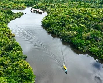
Iquitos
Gateway to northern Amazon, accessible only by air or river

Manu National Park
UNESCO World Heritage biodiversity hotspot

Tambopata
Wildlife lodges and macaw clay licks
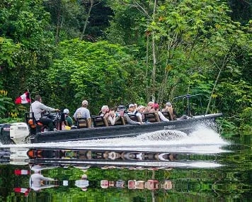
Pacaya Samiria
Vast flooded forest reserve
The Amazon rainforest Peru transitions dramatically from cloud forests at higher elevations, where mist-shrouded vegetation clings to steep slopes, to vast lowland plains where mighty rivers meander through dense jungle.
Peru Landforms and Rivers
Shaping the Landscape
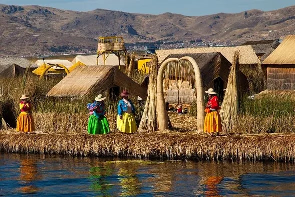
Peru landforms and rivers create a complex geographical tapestry that has shaped human settlement patterns for millennia. The country’s drainage patterns flow in three directions: westward to the Pacific, eastward to the Atlantic via the Amazon, and into internal basins like Lake Titicaca.
Major River Systems
River System
Length in Peru
Destination
Importance
Amazon
Varies
Atlantic Ocean
World's largest by volume
Ucayali
1,771 km
Amazon Confluence
Longest Peruvian river
Amazon Region
1,600 km
Amazon Confluence
Major Amazon Tributary
Santa
347 km
Pacific Ocean
Largest Pacific Flowing River
Urubamba
724 km
Ucayali
Sacred Valley Waterway
Distinctive Landforms:
Altiplano
High plateau shared with Bolivia, hosting Lake Titicaca at 3,812m
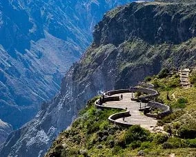
Colca Canyon
One of the world’s deepest canyons at 3,270m

Coastal Valleys
Fertile agricultural oases between desert expanses
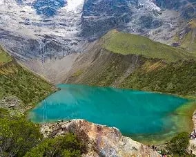
Glacial Lakes
Stunning turquoise waters throughout Andean ranges
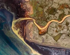
River Deltas
Mangrove ecosystems in northern coastal regions
Natural Hazards Peru Geography
Understanding the Risks
The natural hazards Peru geography presents stem primarily from the country’s location along the Pacific Ring of Fire, where tectonic forces create significant seismic and volcanic activity. Natural hazards that Peru experiences include earthquakes, tsunamis, flooding, landslides, and mild volcanic activity.

Primary Natural Hazards:
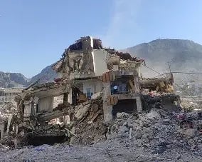
Earthquakes
Peru averages over 100 detectable earthquakes annually due to Nazca Plate subduction
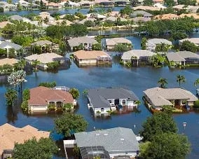
Tsunamis
Coastal regions vulnerable to earthquake generated ocean waves
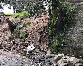
Landslides
Common in mountainous areas during rainy season (December-March)
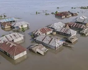
Flooding
El Niño events can cause devastating floods
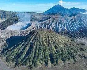
Volcanic Activity
Southern Peru contains several active volcanoes including Ubinas and Sabancaya
The most disastrous earthquake to hit the country was in 1970 and struck the Ancash region of Peru, causing mass landslides that resulted in the deaths of about 70,000 people. This tragic event buried the town of Yungay beneath an avalanche from Huascarán and remains one of the worst natural disasters in Andean history.
Climate Zone Comparison
Region
Climate Type
Temperature Range
Annual Rainfall
Costa
Subtropical Desert
18-26°C (64-79°F)
<250mm
Sierra
Highland/Alpine
5-20°C (41-68°F)
500-1,000mm
Selva
Tropical Rainforest
24-30°C (75-86°F)
2,000-4,000mm
Contact Us
Contact Information
Find Our Contact Details for Quick Assistance and Personalized Travel Support.
Location
Lima, Peru
Call Us
Get In Touch
* Tell Us About Your Travel Plans & How We Can Help!
Frequently Asked Questions
What are Peru's three main geographic regions?
Peru geographic regions consist of the Costa (coastal desert), Sierra (Andes mountains), and Selva (Amazon rainforest), each with distinct climates and ecosystems running north to south.
What is the highest mountain in Peru?
Huascarán in the Cordillera Blanca Peru stands at 6,768 meters (22,205 feet), making it Peru’s highest peak and the highest tropical mountain in the world.
How much of Peru is covered by the Amazon rainforest?
The Amazon rainforest Peru covers approximately 60% of the country’s territory, representing the largest of the three geographic regions and hosting exceptional biodiversity.
Why is the coastal region of Peru so dry?
The coastal region of Peru remains arid due to the cold Humboldt Current preventing cloud formation, combined with the rain shadow effect created by the towering Andes Mountains.
What natural hazards should visitors to Peru be aware of?
Natural hazards Peru geography includes earthquakes (most common), tsunamis along the coast, landslides in mountains during rainy season, and occasional volcanic activity in southern regions.
What makes the Cordillera Blanca special?
The Cordillera Blanca Peru is the world’s highest tropical mountain range, featuring 27 peaks above 6,000 meters, over 700 glaciers, and stunning landscapes protected within Huascarán National Park.
How do Peru's rivers flow?
Peru landforms and rivers create three drainage patterns: westward to the Pacific (short, steep rivers), eastward to the Amazon (long tributaries), and into internal basins like Lake Titicaca.
What are Peru's altitudinal zones?
Peru altitudinal zones range from sea level through Yunga (500-2,300m), Quechua (2,300-3,500m), Suni (3,500-4,000m), Puna (4,000-4,800m), to Janca (above 4,800m), each with unique characteristics.
How does Peru's terrain affect travel?
Peru’s terrain creates dramatic elevation changes requiring acclimatization for mountain regions, while transportation between regions often involves long journeys due to the Andes barrier.
What role do the Andes play in Peru's geography?
The Andes in Peru serve as a continental divide, climate barrier, and cultural backbone, creating distinct ecosystems on either side while hosting ancient civilizations and modern communities throughout their valleys and plateaus.